
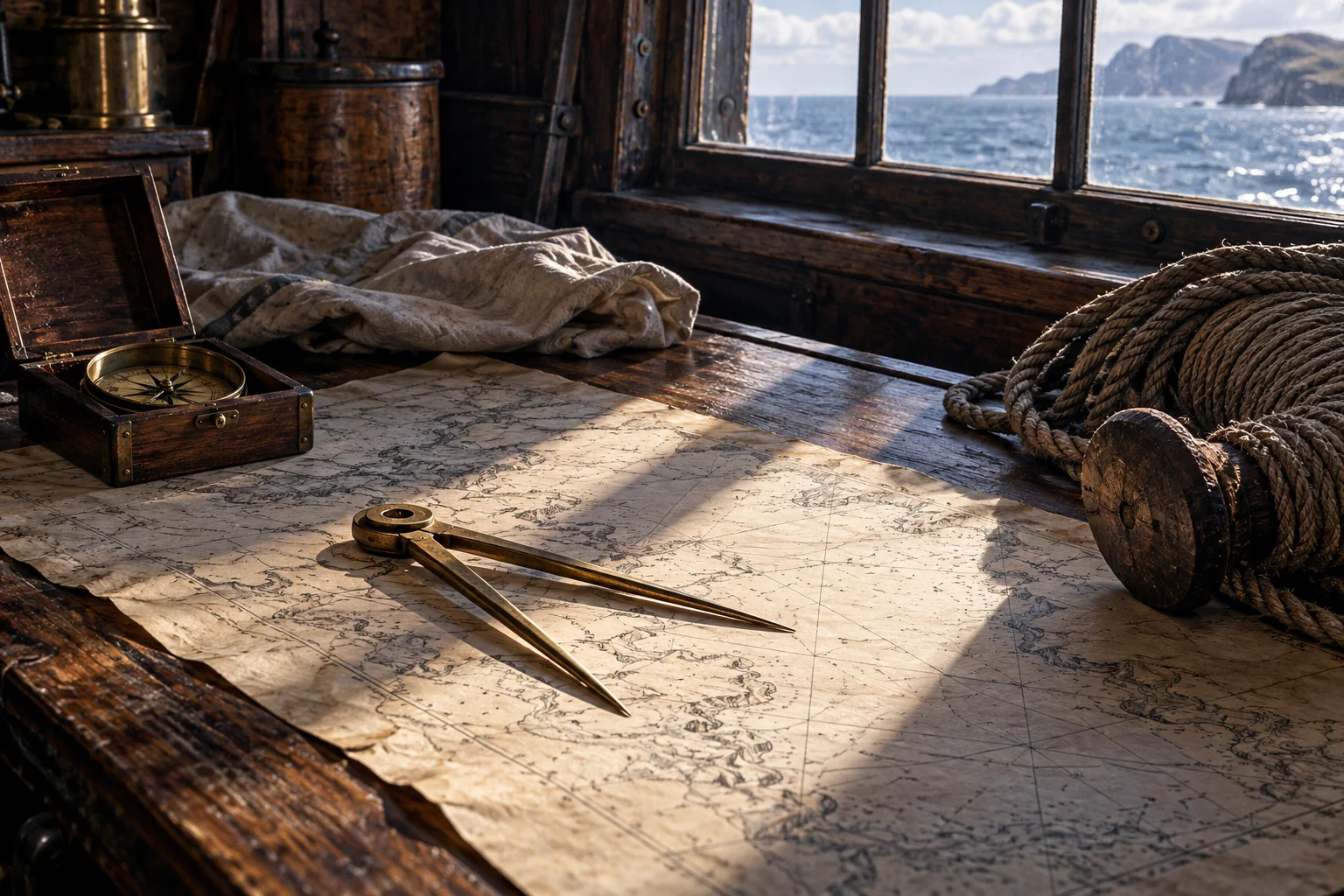
One instrument does not give a complete position
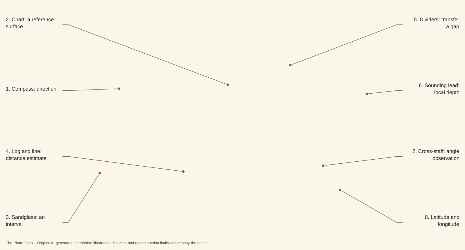
“How did they navigate?” contains several questions. Which way are we heading? How far have we traveled? How deep is the water here? Where do we think we are on the chart? A tool that helps with one does not automatically answer the others.
Position, heading, distance and depth are different kinds of information. Combining them here does not reconstruct a documented voyage. This explanation connects tasks rather than claiming a verified sequence followed by Blackbeard. Use it to keep the questions separate before examining the objects.
The strongest material in this page is object-specific: a hinged pair of dividers and sounding weights recovered by the QAR project. We do not invent a complete instrument inventory from those examples.
The log and sandglass visualize a combination of distance-related information and time. No precise historical speed or calibration is inferred from this drawing.
William FalconerDividers: work on the chart
The project records dividers used in chart work, with the hinge surviving but the steel points missing. It compares them with a pair recovered from the Whydah Galley. That is evidence of an instrument type and a material comparison, not a log of the calculations performed with it. [1]
Think of two separate layers: the tool makes a task possible; a source about a particular voyage may show that the task was performed. Confusing those layers turns a find into a story it cannot tell on its own.
The basic geometry is the relationship between a measured separation on the chart and the chart’s scale. It does not reproduce the exact excavated object or supply a scale derived from an image.
Sounding: the water immediately below
A recovered lead sounding weight was attached to a line and used to investigate water depth and the character of the bottom. This concerns a local condition below the vessel. It does not directly read latitude or longitude. [2]
A depth measurement is valuable precisely because it answers a different question from a chart. A chart represents an area; a sounding samples the water at the place of observation. The distinction is conceptual and useful even without pretending to know a captain’s exact decision.
Depth and position are complementary; neither is a universal substitute for the other.
Latitude and the harder longitude question
The Royal Observatory’s overview notes that by around 1700 skilled seamen could establish latitude while accurate longitude remained a major difficulty. Capability was not a guarantee under every sky and circumstance. The words north–south and east–west help explain why these were separate problems. [3]
A modern map pin bundles both into a single effortless symbol. Historical navigation is easier to understand when we unpack that symbol. A crew’s estimate could combine several kinds of information without any one observation delivering a perfect position.
This page does not assign an accuracy figure to an unnamed crew or claim that one recovered tool resolves the entire problem.
The simple cross-staff type is distinct from a later sextant or marine chronometer. Its presence in a manual is not proof of its use on a particular pirate voyage.
John Smith · Royal Observatory Greenwich · Royal Museums GreenwichThe route described in the early account
Johnson’s preface describes merchant vessels reaching the latitude of their intended American or West Indian destination and then steering west. He uses this account to argue that naval patrols should intercept pirates on the same trading routes. The passage is a contemporary author’s generalization, not a log proving that every ship followed one route. [4]
This connects navigation to the commercial world. A route was not just a line on a chart: it could also be where an attacker expected to find a particular kind of cargo. Johnson explicitly links cruising choices to wanted provisions and stores. His argument is partisan, but it reveals the relationship he wants readers to see between routes, commerce and predation. [4]
Do not put a later chronometer into 1718
Harrison’s H1 sea trial took place in 1736; later timekeepers and trials continued well beyond that. The museum also explains that broad availability of marine chronometers developed slowly. A mature chronometer should not appear as routine equipment in an illustration of Blackbeard’s last year. [5]
There is a broader lesson here: the date of an invention, a successful test and widespread adoption are not the same milestone. A historical tool list should say which one it means.
To explore the people behind these tasks, use the master and specialist roles. For the vessel they worked aboard, return to rig and ship terminology. The combination of tools, skills and dated evidence gives a clearer account than a pile of nautical props.
Questions, answered.
Did a sounding lead show longitude?
No. The source describes measuring water depth and bottom consistency. Longitude is a different question.
Could Blackbeard have routinely used Harrison’s successful chronometer?
That would be anachronistic. H1’s sea trial was in 1736, after the chapter’s 1718 setting, and wider adoption came later.
Sources & reading notes
Source checks distinguish an artifact, a reported account and a modern interpretation. They do not constitute independent historian review.
- DividersNC Office of State Archaeology · Archaeological collection
Dividers artifact entry, surviving hinge, missing steel points and Whydah comparison. A recovered instrument is evidence of equipment, not proof of a particular route calculation.
- Sounding weightNC Office of State Archaeology · Archaeological collection
Lead sounding weight entry, depth and bottom sampling. Measures local water depth rather than latitude or longitude.
- Time and Longitude galleryRoyal Observatory Greenwich · Museum overview
Royal Observatory explanation of latitude and longitude around 1700. Latitude capability does not imply an accurate position under every condition.
- A General History of the Pyrates (1724)Published under the name Captain Charles Johnson · Early printed account; public-domain text
Preface, discussion of merchant routes and proposed patrol interception; the compiler’s generalization rather than a ship’s log. Authorship is disputed. A near-contemporary compilation, not a surviving signed pirate code or a neutral transcript. Cite its claims as reported claims.
- Harrison’s clocks and the longitude problemRoyal Museums Greenwich · Museum history of science
Harrison account, H1’s 1736 trial and later development; invention is not widespread adoption. Later chronology explains why a mature chronometer is anachronistic for 1718.